

Hiking trail Herzogenrath - Alsdorf (10.2 km)

Hiking trail Herzogenrath - Alsdorf (10.2 km)
Didi'ms world
Last Sunday I walked a walking route of 10.2 km. This time the route came from the site routeyou.com. Over the past few weeks we have walked several routes that were usually followed by a.d.h.v. an itinerary. That doesn't always work smoothly with us, especially if they are older routes so this time we chose a route that is indicated on a map without further descriptions except for the start and end point.

The route looked like this on the photo. We wanted to try this way because sometimes a description can be quite tricky. Especially for my love who wants to walk from point to point and some descriptions give so much extra information that it can be confusing. Sometimes they seem like quests, also fun but not always efficient.
At the starting point of this route there are many parking spaces so if you come by car then that is ideal. Also, the starting point is easy to reach by public transport. A train stops in Herzogenrath and from the station to the starting point is not very far. You can also take the bus to. If you get out somewhere at the center then it is easy to walk so that too should be no objection..
We walked to the starting point but did not reach the starting point but a little further along the route and then decided to continue the route from there.
We scanned the route with the code at the top right and that was a great tool on the way as there was no signage.
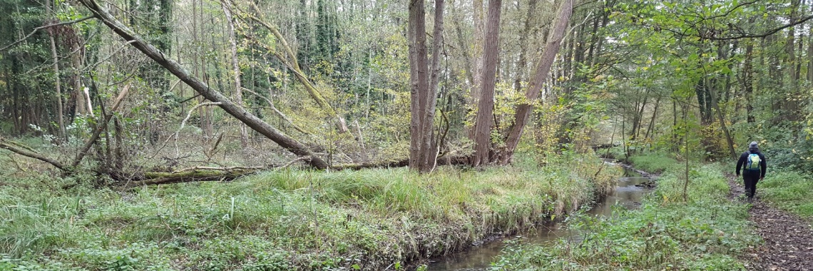
The other routes did not have this and in itself this was nice, especially for my dear who still likes some support while walking. On the first part we met many hikers. Pretty many people walking the dog, couples and families. It is also a nice area with lots of benches where you can relax.. Here at most benches there were also trash cans. I liked it actually and because they were so massive here I realized that you don't see this very often nowadays. I didn't take a lot of pictures this time. But I will share the pictures I took here so you can get an impression of the area. You can see on the map that you walk a lot past ponds and you also follow a small river. You walk past houses every once in a while, but those are just small pieces. The route is easy to pass and most of the you walk on paved roads or roads or well-laid roads. You do not often walk on forest roads, although there are, but also here without any real bumps on the way. So the untrained hiker can walk this route just fine. The forest paws are sometimes narrow and therefore not suitable for wheelchair users.

then €5.99/month after 14 days
Start your 14-day free trial now to publish your sponsored content. Cancel anytime.